Community Corner
Walk About Martinez -- Waterbird Regional Preserve
A little surprise on the edge of heavy industry when we go looking for birds at the East Bay Regional Park District's, Waterbird Regional Preserve, this week in Walk About Martinez.


I stepped out of the car at Waterbird Regional Preserve, situated on the edge of the Shell Refinery, and immediately noticed a distinct lack of birds, not a one, not on the water, not in the air. Shell Oil’s towers and labyrinthine pipes and catwalks crawled skyward, a surreal landscape of monumental industrialism, as cars sped by on Highway 680, all forming a very unnatural backdrop to the pristine, Al McNabney Marsh, but there was not a bird in sight.
I was disappointed and thought to come back another day when I caught a flash of movement to my right. I spun around, and saw nothing. More movement just above, as a shadow streaked across the ground, and this time he flew fifteen feet above me right over my head and into my field of vision. It was a northern harrier, a magnificent bird of prey that skims the landscape often just feet off the ground, hoping to swoop over a rise and snatch some little critter for a meal.
Find out what's happening in Martinezwith free, real-time updates from Patch.
He soared overhead and then dove low to the ground, zooming just over the grass on the hills and topping the reeds in the marsh, hunting with amazing displays of aerial prowess. I’m not a birder, but the white band above the tail and his in-flight acrobatics made identification easy. The British Harrier Jet that can take off and land vertically is named after this raptor. A red tailed hawk or an eagle will soar at a great height and then dive on its prey. The harrier gets in close and for the spectator on the ground, puts on a display like an old barnstorming show without the noise of engines.
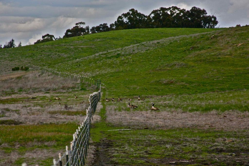
As he dusted last year’s dried cattail brakes, crisscrossing his path again and again, I realized why there were no birds. He was hunting them. In the distance south of the parking lot on Waterbird Way, I could just make out some of the larger inhabitants of the marsh, a snowy egret stood in the shallows and a flock of Canada geese plodded in the mud on shore.
Find out what's happening in Martinezwith free, real-time updates from Patch.
Formerly known as Shell Marsh, The East Bay Regional Park District and Mountain View Sanitary District each own a good portion of the marsh which is studded across its length with small islands and stands of tules that provide important nesting habitat for many different bird species. It is a tidal marsh but much of its water comes directly from the man-made, Moorhen Marsh on the opposite side of Highway 680. Moorhen Marsh is the first wetland on the West Coast to use treated effluent as its primary water source. That treated waste water drains into the Al McNabney Marsh where it feeds a rich wetland habitat.
Situated as it is on the Pacific Flyway, the West’s most important migratory route to and from Canada and the Arctic, this marsh provides stopover for many species of birds flying to and from those summer feeding grounds. As I began my walk leaving the parking lot on a dirt road south into the heart of the preserve, the marsh looked like it was thriving. It hasn’t always looked this good.
On April 23, 1988, a drainpipe on a twelve-million gallon oil tank ruptured at the Shell Refinery. A safety valve had inadvertently been left open and over four-hundred-thousand gallons of San Joaquin Valley Crude spilled into Peyton Slough and the marsh over which my harrier now flew. As the crude made its way to the Carquinez Straits and the whole system of waterways that make up the San Francisco Bay and California Delta, and thousands of miles of shoreline, the first responders made the decision to boom the marsh and contain the oil, sacrificing one ecosystem to preserve another.
The cleanup took fourteen months and cost Shell over $12,000,000, ultimately affecting fifty miles of shoreline and killing hundreds of birds. The early descriptions were of a marsh four inches deep in thick crude. It was blotted and vacuumed up and any despoiled vegetation was cut out by hand. The cleanup process was exacerbated by the fragility of the marsh environment which has been likened to tundra which can be damaged by human footprints. The marsh recovery crews had to weigh the damage caused directly by the oil versus the damage of their own cleanup efforts.
Today the marsh is fenced off to allow visitors, and the resident cows, to approach the water, but not get close enough to trample the vulnerable shoreline.
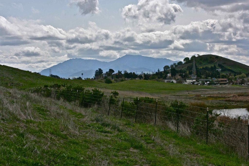
Walking out the dirt trail from the parking lot and over a rise, I found myself in rolling pasture land, a herd of cows standing about feeding peacefully on the thick spring grass which I found dotted with small clumps of blue-eyed grass, California’s smallest iris. To the east, juxtaposed to this bucolic scene, were the machines of the waste transfer station, or was it a local chemical company, rising above the horizon. On the west, Shell’s ever present structures loomed above and Highway 680 roared along below.
Yet here between was an island of green hills and cattle, carpets of golden flowers on the water’s edge and as I approached the south end of the marsh, birds. Here’s where they were holed up. Red-winged black birds, perched on the reed ends, mallards and coots and that flock of Canada geese that took off at my approach as I walked back along the fence line. Two vultures fed on something in the grass up hill from me, undaunted by my presence, and fairy ring mushrooms fruited along the path. They were Agaricus campestris, the meadow mushroom, a relative of the common button mushroom we find in stores, Agaricus bisporus. It’s the first mushroom I learned to pick when I was a teenager and found them growing in great number on the foothills of Mt. Diablo.
Giant puffballs dotted the grass, usually one of the last mushrooms to fruit at the end of the rainy season and a great splash of feathers marked the spot where some bird had become dinner for a predator.
All the while I could see that harrier still buzzing the tules and hills at the northern end of the marsh where there were no birds, and I wondered if he did it intentionally to drive them all to the south end? Was he herding them to one place where he would eventually dive bomb the masses when they let down their guard?
I don’t know, I’m not a birder, but this marsh is named after one. Al McNabney was one of the most influential birders in Contra Costa County. A member of the Audubon Society for years, he fought many environmental battles to preserve lands needed to sustain our natural wildlife communities. He has been called “the environmental conscience of Contra Costa County.” Shell Marsh had been a particular favorite of his. After the oil spill, he worked toward the eventual settlement with Shell that produced the pristine bit of waterbird habitat I now hiked in. Because of his efforts the marsh was posthumously renamed in his honor.
This is an easy hike of a few hundred feet or a mile, depending on how far you want to go and it’s mostly on level ground. It's a place to wander about and spend time watching the birds. Bring your binoculars.
Only a few minutes from downtown Martinez and sandwiched as it is between heavy industry on both sides, Waterbird Regional Preserve is beautiful and the life abundance here is remarkable. The grass grows, flowers bloom, and numerous species of birds make a home. Given even half a chance, many of our wild neighbors can sustain themselves on small bits of preserved land, even in water that is treated effluent. This little piece of shoreline, protected from our heavy foot steps and cleaned of the disasters of the past is one such place, and it’s a surprisingly lovely spot to take a walk.
To get there exit Highway 680 at Marina Vista and turn right and right again onto Waterbird Way. You can’t miss it. It is a wildlife preserve and dogs are not permitted. You can find information about the preserve and a wonderful slide show at this link.
“Any glimpse into the life of an animal quickens our own and makes it so much the larger and better in every way.” John Muir